
Annapurna Circuit Trek Distance and Altitude Profile
The Annapurna Circuit is one of the world’s most stunning trekking routes. But for many, the real challenge is figuring out how far it stretches, how high you’ll climb, and how long it takes. While the mountains are breathtaking, it’s the planning that makes your experience smooth and rewarding.
Many trekkers worry about altitude, daily hiking distance, and crossing Thorong La Pass safely. The Annapurna Circuit Trek distance spans from valley trails at 800 m to the mighty Thorong La Pass at 5,416 m.
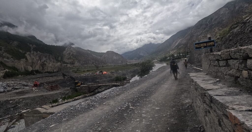
With rapidly changing trails due to road development, the Annapurna Circuit Trek Distance can vary. But whether you’re trekking the classic full route or a shortened modern version, you’ll still face a dramatic journey through deep valleys, alpine forests, and high mountain passes. The trek demands preparation but offers unforgettable cultural and natural rewards.
Quick Overview of the Annapurna Circuit
The Annapurna Circuit is a world-renowned trek that circles the majestic Annapurna Massif. It offers an incredible variety of landscapes, from lush subtropical forests to arid, high-altitude deserts.
- Total trekking distance: typically 160–230 km, depending on road‑shortened sections
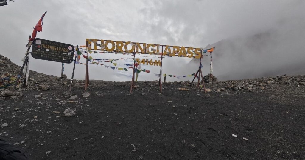
- Max altitude at Thorong La Pass: 5,416 meters (17,769 ft), the highest point of the trek.
- Estimated days required: 15–20, sometimes shorter if using jeeps/road stretches.
- Start and end points: typically Besisahar or Dharapani to Nayapul/Jomsom, ending in Pokhara or Kathmandu.
- Terrain overview: The trail winds through river valleys, terraced fields, rhododendron forests, and barren, rocky landscapes resembling the Tibetan plateau.
How Long is the Annapurna Circuit Trek?
The classic Annapurna Circuit Trek distance was approximately 230–260 kilometers (143–161 miles), starting from Bhulbhule and ending at Nayapul. However, this full route is rarely walked today due to road developments that have altered the trekking experience.
The modern Annapurna Circuit trek typically covers 136 to 180 kilometers (85 to 112 miles), depending on your starting and ending points. Many trekkers now drive from Besisahar to Jagat, Dharapani, or even Chame, skipping the lower, less scenic stretches of the trail. Similarly, after crossing Thorong La Pass (at an altitude of 5,416 meters), it’s common to take a jeep from Muktinath to Tatopani or Jomsom, further reducing the walking distance.
These adjustments allow trekkers to avoid dusty motor roads and focus on the most remote and breathtaking parts of the Himalayas, including the Marsyangdi Valley, Thorong La Pass, and Kali Gandaki Gorge.
For a clearer picture of route variations, elevations, and transport-accessible points, refer to a detailed Annapurna Circuit Trek Map.
Altitude Profile of the Annapurna Circuit
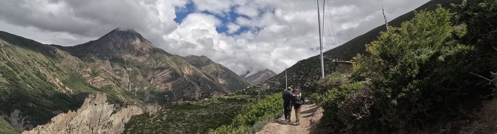
The Annapurna Circuit trek elevation profile is a journey of gradual ascent followed by a sharp descent. This carefully planned progression is the key to successfully and safely crossing the high pass. You will feel the air thin and the landscape change dramatically as you gain altitude each day.
The trek begins at a relatively low elevation, around 820 meters (2,690 ft) in Besisahar, and climbs steadily over several days. You reach a critical acclimatization point in Manang at 3,540 meters (11,614 ft). From here, the ascent becomes steeper as you push towards the trek’s highest point, Thorong La Pass, at a breathtaking 5,416 meters (17,769 ft). After conquering the pass, the trail descends rapidly to Muktinath at 3,800 meters (12,467 ft), offering immense relief and a completely different perspective of the mountains.
Day-by-Day Annapurna Circuit Itinerary with Distance and Elevation
This Annapurna Circuit trek itinerary lays out each day for you in a simple way. You get a good mix of walking and driving, so you can see a lot without wearing yourself out. Each day, you’ll find new things to enjoy, like mountain views, Nepali villages, and peaceful scenery. The plan has you go higher bit by bit, which really helps your body get used to the altitude. That makes it much easier to cross the famous Thorong La Pass later in the trek.
If you want more info, like how high you’ll go each day, different route choices, or tips to plan your trek, check out the full Annapurna Circuit trek itinerary and cost. They’ve got all the practical advice you need. Taking your time to climb helps you feel good, enjoy the hike, and soak in all the awesome places on the Annapurna Circuit.
Day 1: Kathmandu to Besisahar (Drive) to Chame
- Journey: Drive
- Distance: Approx. 240 km / 149 miles
- Duration: 9-10 hours
- Altitude: 2,670 m / 8,760 ft at Chame
Your adventure begins with a scenic drive from Kathmandu. You’ll leave the city’s hustle behind for the winding roads of the Prithvi Highway.
The journey takes you through lush green hills and alongside the roaring Trishuli River. After reaching Besisahar, the former starting point of the trek, you will switch to a 4WD jeep for a rugged but spectacular drive to Chame, the administrative headquarters of the Manang district.
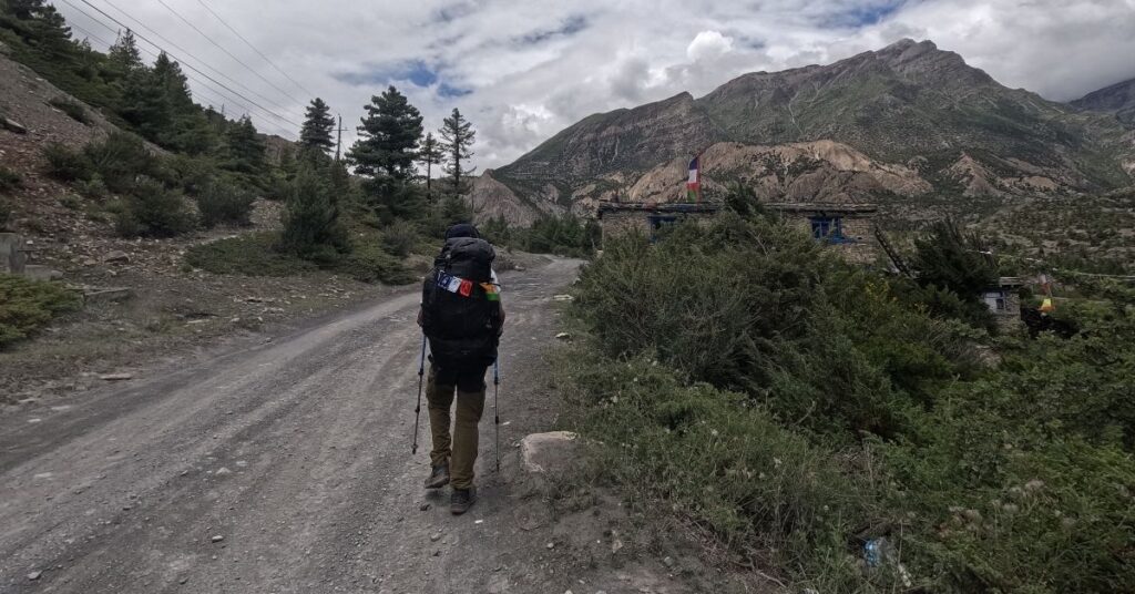
Day 2: Chame to Pisang
- Trekking Distance: Approx. 14 km / 8.7 miles
- Duration: 5-6 hours
- Altitude: 3,200 m / 10,500 ft at Pisang
Today is your first official day of trekking. The trail follows the Marsyangdi River through dense forests of pine and rhododendron.
You will pass through the charming village of Bhratang, known for its apple orchards. As you climb higher, the valley opens up, revealing stunning views of Annapurna II and Pisang Peak. The day ends in the beautiful village of Pisang.
Day 3: Pisang to Manang
- Trekking Distance: Approx. 17 km / 10.5 miles (via lower route)
- Duration: 6-7 hours
- Altitude: 3,540 m / 11,614 ft at Manang
You have two route options today: the lower, easier trail or the more challenging upper trail via Ghyaru and Ngawal. The upper route offers unparalleled views of the Annapurna range.
Both trails converge in Manang, a large village nestled in a wide valley. The landscape becomes noticeably drier and more barren here. This signifies your entry into the rain shadow of the Annapurna Massif.
Day 4: Acclimatization Day in Manang
- Trekking Distance: Varies based on activity
- Duration: N/A (Rest Day)
- Altitude: 3,540 m / 11,614 ft
This day is vital for your success. Staying active helps your body adjust to the high altitude, reducing the risk of altitude sickness.
You can take short hikes to nearby viewpoints like Gangapurna Lake or the “Hundred Rupee Lama” at Praken Gompa. These hikes offer incredible scenery and prepare you for the higher altitudes to come. Proper acclimatization is key to managing the challenges of the Annapurna trek.
Day 5: Manang to Yak Kharka
- Trekking Distance: Approx. 10 km / 6.2 miles
- Duration: 4-5 hours
- Altitude: 4,050 m / 13,287 ft at Yak Kharka
Leaving Manang, the trail climbs steadily out of the Marsyangdi Valley. The vegetation becomes sparse, replaced by alpine grasses and scrub juniper.
You are now in true high-altitude territory. You might see yaks grazing on the sparse vegetation, which is how Yak Kharka (“Yak Pasture”) gets its name. The pace is slow and steady to conserve energy.
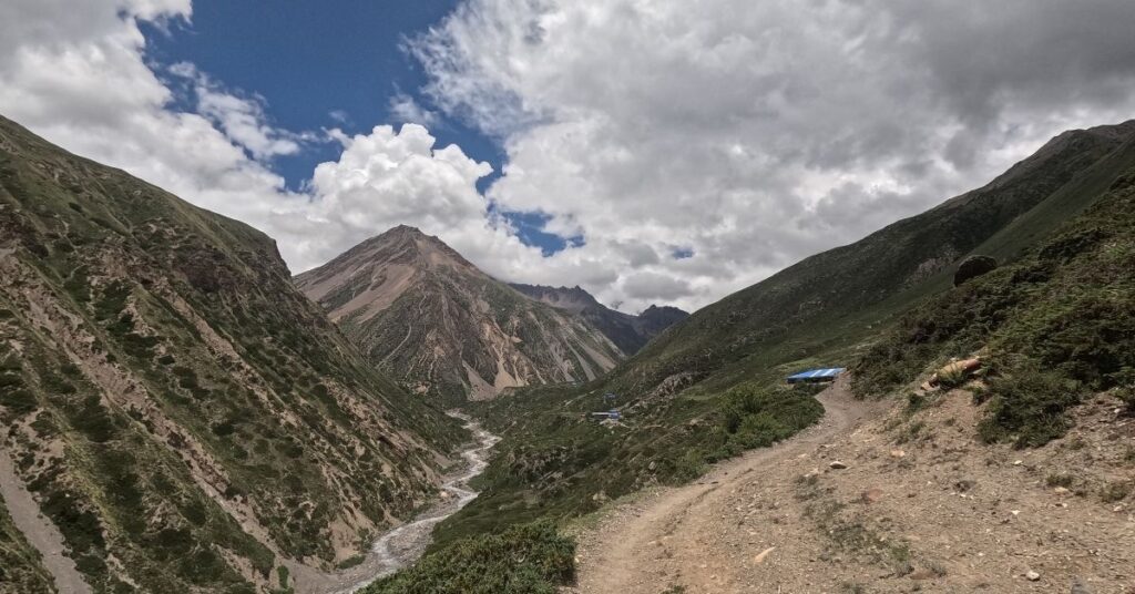
Day 6: Yak Kharka to Thorong Phedi or High Camp
- Trekking Distance: Approx. 6 km / 3.7 miles
- Duration: 3-4 hours
- Altitude: 4,525 m (Phedi) / 4,925 m (High Camp)
This is a short but important trekking day. It positions you perfectly for the challenging pass crossing tomorrow.
You will trek to Thorong Phedi (“Foot of the Pass”), a basic settlement at the bottom of the pass. Depending on your condition and the guide’s advice, you may push on for another hour to High Camp. Staying at High Camp makes the next day shorter, but the night colder and more difficult.
Day 7: Thorong Phedi to Thorong La Pass to Muktinath
- Trekking Distance: Approx. 16 km / 10 miles
- Duration: 8-9 hours
- Altitude: 5,416 m (Thorong La Pass) / 3,800 m (Muktinath)
Today is the ultimate challenge and reward. You will start before dawn, trekking up a series of steep switchbacks under the stars.
Reaching the prayer flags at the Thorong La Pass altitude of 5,416 meters, is an incredible achievement. After celebrating, you face a long, sharp descent into the arid Kali Gandaki Valley. You finally arrive at Muktinath, a sacred pilgrimage site for both Hindus and Buddhists.
Day 8: Muktinath to Tatopani (via Jeep or Trek)
- Journey: Drive
- Distance: Approx. 95 km / 59 miles
- Duration: 5-6 hours drive
- Altitude: 1,200 m / 3,937 ft at Tatopani
After exploring the Muktinath temple complex, you will take a jeep. The drive down through the Kali Gandaki Gorge, the world’s deepest gorge, is an adventure in itself.
You’ll pass through villages like Jomsom and Marpha, famous for their apples and architecture. The day ends in Tatopani, which means “hot water” in Nepali. You can soothe your tired muscles in the natural hot springs here.
Day 9: Tatopani to Ghorepani
- Trekking Distance: Approx. 17 km / 10.5 miles
- Duration: 7-8 hours
- Altitude: 2,874 m / 9,429 ft at Ghorepani
The trail climbs once again today. You will leave the river valley behind and ascend through terraced fields and dense rhododendron forests.
This is a challenging day of uphill trekking, but it marks the final climb of your journey. Reaching the large village of Ghorepani feels like a great accomplishment. It is the gateway to the famous Poon Hill viewpoint.
Day 10: Ghorepani to Poon Hill to Nayapul – Drive to Pokhara
- Trekking Distance: Approx. 12 km / 7.5 miles
- Duration: 6-7 hours
- Altitude: 3,210 m (Poon Hill) / 820 m (Pokhara)
An early morning hike takes you up to Poon Hill. You will witness a spectacular sunrise over the Annapurna and Dhaulagiri mountain ranges.
After breakfast, back in Ghorepani, you will begin the final descent through beautiful forests and villages to Nayapul. From there, a short drive will take you to the lakeside city of Pokhara, where your incredible trek concludes.
Distance and Altitude Table of Annapurna Circuit Trek
This table provides a quick reference for the daily distance, duration, and altitude changes on a typical 10-day Annapurna Circuit trek.
| Day | Route | Distance (km/miles) | Duration (hours) | Altitude (m/ft) |
| 1 | Drive to Chame | 240 km / 149 mi | 9–10 | 2,670 m / 8,760 ft |
| 2 | Chame to Pisang | 14 km / 8.7 mi | 5–6 | 3,200 m / 10,500 ft |
| 3 | Pisang to Manang | 17 km / 10.5 mi | 6–7 | 3,540 m / 11,614 ft |
| 4 | Acclimatization in Manang | Varies | – | 3,540 m / 11,614 ft |
| 5 | Manang to Yak Kharka | 10 km / 6.2 mi | 4–5 | 4,050 m / 13,287 ft |
| 6 | Yak Kharka to Thorong Phedi | 6 km / 3.7 mi | 3–4 | 4,525 m / 14,845 ft |
| 7 | Thorong Phedi to Thorong La to Muktinath | 16 km / 10 mi | 8–9 | 5,416 m / 17,769 ft (Pass) |
| 8 | Drive from Muktinath to Tatopani | 95 km / 59 mi | 5–6 | 1,200 m / 3,937 ft |
| 9 | Tatopani to Ghorepani | 17 km / 10.5 mi | 7–8 | 2,874 m / 9,429 ft |
| 10 | Hike Poon Hill, Trek to Nayapul, Drive to Pokhara | 12 km / 7.5 mi | 6–7 | 820 m / 2,690 ft (Pokhara) |
How Does the Altitude Affect Trekking Difficulty?
Altitude is the single biggest factor affecting the difficulty of the Annapurna trek. As you climb higher, the amount of oxygen in the air decreases, forcing your body to work harder. This can lead to symptoms of Acute Mountain Sickness (AMS) if you ascend too quickly.
The key to a safe trek is gradual acclimatization. The itinerary is designed with this in mind, including a specific rest day in Manang and short trekking days before the pass. Listen to your body, walk at a slow pace, drink plenty of water, and communicate any symptoms, such as headaches or dizziness, to your guide immediately. A well-planned itinerary makes the challenge of altitude manageable for most fit trekkers.
Optional Variations to the Route
The classic circuit offers plenty of adventure, but you can also add side trips to enhance your experience. These variations add to the trek’s distance and difficulty but reward you with unique landscapes and fewer crowds.
Tilicho Lake side trip: The journey to Annapurna Circuit with Tilicho Lake Trek includes a challenging 2–3 day detour from Manang to one of the world’s highest lakes. It significantly increases the overall difficulty, but it’s an unforgettable experience.
Short circuit exit via Jomsom flight: To save time, you can fly from Jomsom back to Pokhara after crossing the pass. This shortens the trek by 2-3 days, skipping the trek down to Tatopani and Ghorepani.
Route via Ngawal or Upper Pisang: Between Pisang and Manang, you can choose the higher, more scenic route via Ghyaru and Ngawal. This path offers superior views of the Annapurna range and is a great way to aid acclimatization, though it is more strenuous.
Craft the Ideal Annapurna Circuit Plan with Our Local Trek Leaders
By working with trusted guides, you’ll follow a well-paced, flexible itinerary designed for both safety and enjoyment. They handle all the logistics while helping you discover side-trips like Tilicho Lake, ensuring you stay on the right path, physically and culturally. Whether you’re a first-time trekker or an experienced hiker, plans can be customized to your fitness level, rest-day preferences, and desired experiences.
Planning the logistics, permits, and accommodation for the Annapurna Circuit can be complex. Letting our expert local trek leaders handle the details allows you to focus purely on the adventure.
Our team at Mountain Routes ensures your itinerary is perfectly paced for safety and enjoyment. We manage all the logistics so you can immerse yourself in the culture and landscapes of the Annapurna region with complete peace of mind. Connect with us to craft your personalized Himalayan trek.
FAQs
What is the total distance of the Annapurna Circuit Trek?
The full circuit is about 230 km (145 miles). However, most modern itineraries cover 160–180 km (100–112 miles) by using jeeps to skip roaded sections, focusing your effort on the best parts of the trail.
How high is Thorong La Pass?
Thorong La Pass stands at a breathtaking altitude of 5,416 meters (17,769 feet). It is the highest point of the entire trek and a major mountaineering achievement for trekkers.
How many days is ideal for the Annapurna Circuit?
An ideal trek lasts between 12 and 16 days. This provides enough time for proper acclimatization, especially around Manang, and allows for a comfortable pace without rushing. Shorter 10-day itineraries are possible but are more physically demanding.
Is the trail affected by road construction?
Yes, road construction has changed the trek. However, trekking companies have adapted itineraries to avoid these sections. You can now use jeeps to bypass dusty roads and start your trek higher up in the mountains.
Can beginners do the Annapurna Circuit?
Yes, a fit beginner can complete the Annapurna Circuit. You do not need technical climbing skills. The main challenges are the daily long-distance walking and the high altitude. Excellent cardiovascular fitness and mental preparation are essential. Trekking with a guide is highly recommended.


 Chat on WhatsApp