
Complete Manaslu Circuit Trek Route Guide: Maps, Elevation & Itinerary 2026
The Manaslu Circuit Trek route circles the eighth-highest mountain in the world through remote valleys, stone villages, and high mountain passes. The trail moves from warm subtropical forests to cold alpine terrain, reaching Larke La Pass at 5,160 meters before descending toward the Annapurna region. The route stays peaceful and less crowded, which makes the trek feel natural and calm.
This complete guide covers everything you need to plan your Manaslu Circuit trek. You’ll learn the detailed route from start to finish. Discover combine trek options that extend your adventure. The guide includes maps, permits, and best timing for this remarkable Himalayan circuit.
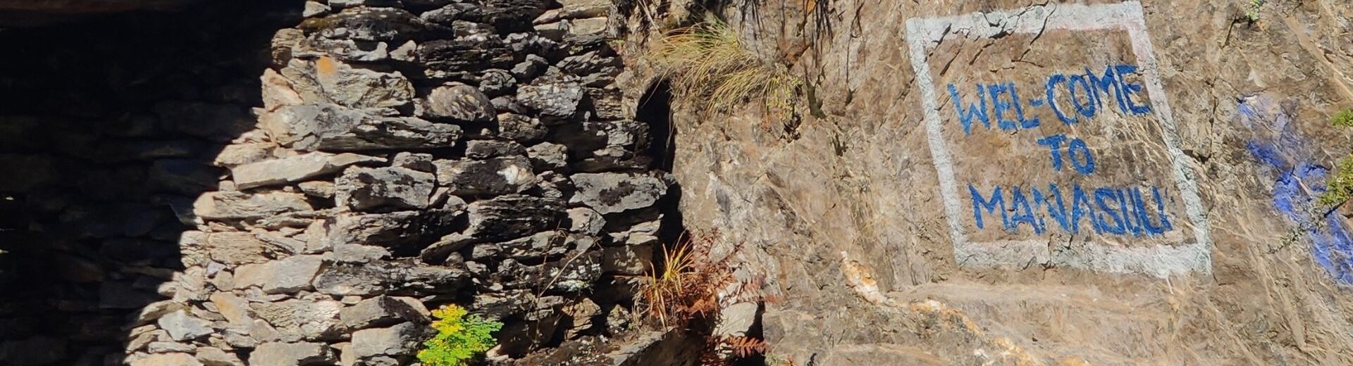
The Manaslu Circuit Trek route also connects with other trails in the region. Many trekkers extend the journey to Tsum Valley, Nar Phu, or even the Annapurna Circuit. The trail offers cultural diversity, massive glaciers, and close views of Manaslu and the surrounding peaks.
Table of contents
- Overview of the Manaslu Circuit Trek
- Complete Manaslu Circuit Trek Route Explained
- Day-by-Day Manaslu Circuit Trek Route with Elevation
- Combine Treks with Manaslu Circuit
- Navigating Your Trek: Manaslu Circuit Map Guide
- Difficulty and Trail Conditions on the Manaslu Circuit Route
- Permits Required for the Manaslu Circuit Trek Route
- Best Time for the Manaslu Circuit Trek
- Final Thoughts
- Frequently Asked Questions
- How long is the full Manaslu Circuit Trek route?
- Can beginners complete the Manaslu Circuit with proper support?
- Is the trail well-marked along the Budhi Gandaki Valley?
- What makes the Manaslu route different from the Annapurna Circuit?
- Is it safe to trek the Manaslu route during light snowfall?
- Can I add extra acclimatization days if I feel slow on the route?
- What transportation options are available at the end of the route?
- Do I need travel insurance for the Manaslu Circuit?
- How much does the Manaslu Circuit Trek cost?
- Can I trek the Manaslu Circuit independently without a guide?
Overview of the Manaslu Circuit Trek
The Manaslu Circuit sits in the western Himalayas of Nepal. It follows the Budhi Gandaki River and climbs toward high alpine valleys near the Tibetan border. The trek takes 12 to 14 days for most itineraries and needs a restricted area permit. A licensed guide is also required because the region is protected.
The trail passes through Gurung and Tibetan-influenced villages. You see terraced fields in the lower areas and snowy landscapes in the higher zones. The walk is steady but challenging near Larke La Pass. The route suits trekkers who want a remote experience with strong mountain scenery.
Trek Statistics:
- Total Distance: 160-180 kilometers
- Duration: 12-14 days standard itinerary
- Highest Point: Larke La Pass (5,160m)
- Starting Elevation: Machha Khola (870m)
- Ending Point: Dharapani/Tilche
- Difficulty Level: Moderate to Challenging
- Best Seasons: Spring (March-May) and Autumn (September-November)
Complete Manaslu Circuit Trek Route Explained
The Manaslu Circuit trail map follows the Budhi Gandaki River from low valleys to high mountain terrain. The route starts in warm hills and slowly climbs into cold alpine zones near Manaslu. Each day brings a gradual change in landscape, culture, and climate. The trail stays steady until the final push to Larke La Pass.
Starting Point: Soti Khola to Machha Khola
The Manaslu Circuit Trek usually begins with a long drive from Kathmandu to Soti Khola or Machha Khola. The drive takes 7-8 hours on rural roads. The lower part of the route sits in a warm and humid valley.
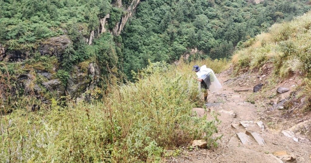
The trail follows the Budhi Gandaki River and stays close to the water for the first few days. You walk on narrow paths that pass through farms, small villages, and suspension bridges. The area has steep cliffs and dense greenery, which makes the first stage of the trek feel wild and scenic.
Trekking Through Dense Forests and Villages
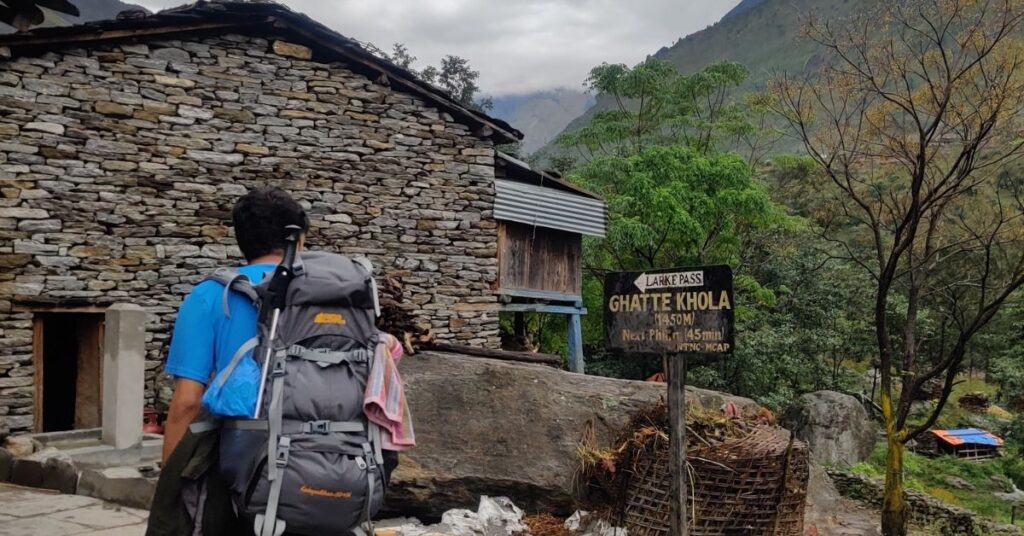
The trail moves deeper into the valley as you head toward Jagat and Deng. The path enters thick forests filled with bamboo, pine, and rhododendron trees. The river becomes stronger and flows through rocky gorges.
The trail has stone steps, long climbs, and short descents. Small villages appear along the route, and each stop offers simple tea houses. You can see local life in terraced fields and watch people carry goods along the narrow paths. The valley stays tight and dramatic during this stage.
Climb Toward Namrung and Lho
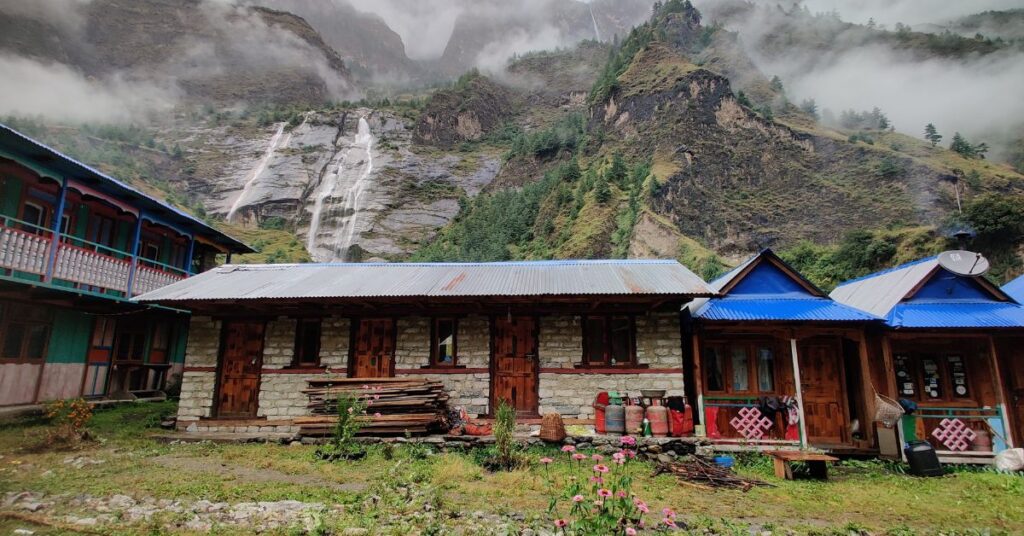
The landscape begins to open as you gain more height. The trail climbs through forests and reaches Namrung, which marks a change in culture and scenery. The air becomes cooler, and the houses show Tibetan-style designs.
From Namrung to Lho and Shyala, the views become wider and clearer. Snow-covered peaks appear on the horizon. You can see Manaslu, Naike Peak, and Himal Chuli from open points on the trail. Monasteries, prayer wheels, and long mani walls stand beside the path, giving the route a calm and spiritual feel.
Enter the High Himalayan Zone
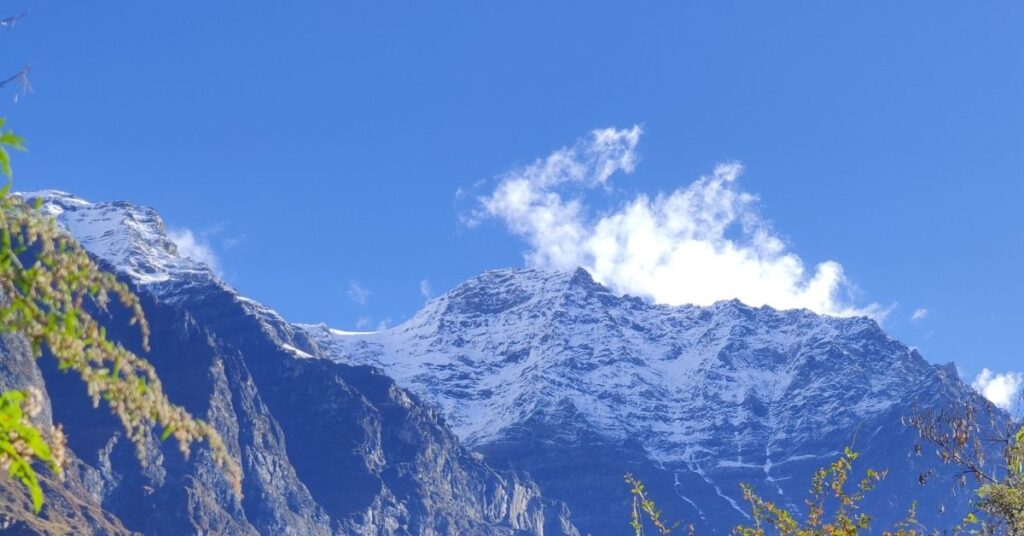
The trail reaches the alpine zone as you walk toward Samagaun and Samdo. Trees begin to fade, and the land turns dry and wide. The villages sit close to the Tibetan border and follow a mountain lifestyle shaped by high altitude.
Most trekkers take an acclimatization day in Samagaun to adjust before moving higher. Clear days offer close views of Manaslu, large glaciers, and long ridgelines. The air feels thinner, and walking becomes slower, but the scenery becomes more dramatic with each step.
Approaching Larke La Pass
The route climbs to Dharmashala, which is the last stop before the pass. The area has basic shelter and sits in a cold and windy zone. Most trekkers start before sunrise to cross Larke La Pass safely.
The climb is gradual but long, and the high altitude makes the walk slow. The pass stands at 5,160 meters and offers wide views of Cheo Himal, Himlung Himal, Kang Guru, and Manaslu. Snow can appear at any time, so this part of the trek needs patience and steady movement.
Descent to Dharapani and the Exit Route
After the pass, the trail drops into a new valley that leads toward Bhimthang. The scenery changes fast as the land becomes green again. You walk past grass fields, pine forests, and streams.
The descent continues through Goa and Tilche, where the villages feel warm and quiet. The route ends near Dharapani, which connects to the Annapurna region road. From here, most trekkers drive to Besisahar and return to Kathmandu.
Day-by-Day Manaslu Circuit Trek Route with Elevation
Understanding the daily elevation changes helps you plan proper acclimatization. The trail to Manaslu Circuit gains altitude gradually until Dharmashala, then climbs sharply to the pass before a long descent.
Manaslu Circuit Elevation Profile
| Day | Route | Starting Elevation | Ending Elevation | Elevation Gain/Loss | Walking Time | Difficulty |
| 1 | Kathmandu to Machha Khola | 1,350m | 870m | -480m | 7-8 hrs drive | Easy |
| 2 | Machha Khola to Jagat | 870m | 1,340m | +470m | 6-7 hrs | Moderate |
| 3 | Jagat to Deng | 1,340m | 1,860m | +520m | 6-7 hrs | Moderate |
| 4 | Deng to Namrung | 1,860m | 2,630m | +770m | 6-7 hrs | Moderate |
| 5 | Namrung to Lho/Shyala | 2,630m | 3,180m/3,500m | +550m/+870m | 4-6 hrs | Moderate |
| 6 | Shyala to Samagaun | 3,500m | 3,530m | +30m | 3-4 hrs | Easy |
| 7 | Samagaun Rest Day | 3,530m | 3,530m | Acclimatization | Rest/Hike | Easy |
| 8 | Samagaun to Samdo | 3,530m | 3,860m | +330m | 4-5 hrs | Moderate |
| 9 | Samdo to Dharmashala | 3,860m | 4,460m | +600m | 3-4 hrs | Moderate |
| 10 | Dharmashala to Bhimthang via Larke La | 4,460m | 3,720m | +700m/-1,440m | 8-10 hrs | Challenging |
| 11 | Bhimthang to Goa/Tilche | 3,720m | 2,510m/2,300m | -1,210m/-1,420m | 6-7 hrs | Moderate |
| 12 | Tilche to Kathmandu | 2,300m | 1,350m | Return | 8-10 hrs drive | Easy |
Combine Treks with Manaslu Circuit
Many trekkers choose to extend the Manaslu Circuit because the region connects with several remote trails. These routes add more culture, higher viewpoints, and longer walking days. Each option offers a different experience based on time, fitness, and travel style.
Manaslu + Tsum Valley Trek
- Additional Days: 6-8 extra days
- Highest Point: Mu Gompa area (3,700m)
- Best For: Cultural immersion and monastery visits
- Total Duration: 18-22 days
The Manaslu and Tsum Valley trek package adds a peaceful side trip before the main circuit. The trail enters a hidden valley known for monasteries and small villages. The area has strong Tibetan influence and quiet paths with fewer trekkers.
The route adds about six to eight extra days to the itinerary. The walk reaches Mu Gompa and Rachen Gompa, which sit in a dry and open landscape. The side trip fits trekkers who want more culture and more time in remote areas. You branch off near Lokpa and rejoin the main circuit at Deng.
Manaslu + Annapurna Circuit
- Additional Days: 10-12 extra days
- Highest Point: Thorong La Pass (5,416m)
- Best For: Long-distance trekkers seeking dual high passes
- Total Duration: 22-26 days
This combination links two major trekking routes in Nepal. The trek continues from Dharapani and moves toward Chame and Manang. You cross Thorong La Pass at 5,416 meters and finish in Muktinath or Jomsom.
The full journey takes more than three weeks and needs strong fitness. The route offers changing scenery, from deep valleys to wide desert landscapes. This option suits trekkers who want a long and challenging adventure with two distinct cultural regions.
Manaslu + Nar Phu Valley
- Additional Days: 5-7 extra days
- Highest Point: Kang La Pass (5,322m)
- Best For: Remote wilderness and rugged terrain
- Total Duration: 17-21 days
The Nar Phu Valley extension adds a remote and wild section after Dharapani. The trail heads toward Koto and climbs into two isolated villages. Nar and Phu sit in a dry and rocky region close to the Tibetan border.
The route crosses Kang La Pass at 5,322 meters and joins the Annapurna trail near Manang. The extension adds five to seven days and needs good acclimatization. This option suits trekkers who want a rugged and less visited path with dramatic landscapes.
Manaslu Base Camp Side Trip
- Additional Days: 1 rest day (used during acclimatization)
- Highest Point: Manaslu Base Camp viewpoint (4,800m)
- Best For: Extra mountain views without extending trek
- Duration: 5-7 hours round trip
The Manaslu Base Camp side trip starts from Samagaun. The trail climbs a steep slope toward the glacier above the village. The viewpoint sits at around 4,800 meters and offers close views of Manaslu and the ice fields.
The hike takes five to seven hours and works well on an acclimatization day. The route does not need extra permits and fits most trekkers with steady pace. This option adds more scenery without changing the main itinerary.
Navigating Your Trek: Manaslu Circuit Map Guide
The Manaslu Circuit Trek map shows the full loop around Mount Manaslu from start to finish. It highlights the trail from Soti Khola to Dharapani and the main stops along the way. The map helps trekkers understand distance, elevation gain, and exit points.
Essential Trail Markers on Your Map
Your map marks the starting point at Machha Khola or Soti Khola, depending on your chosen route. Major villages appear clearly along the way: Jagat, Deng, Namrung, Samagaun, and Samdo. The high point at Larke La Pass sits at 5,160 meters. The exit point leads to Dharapani or Tilche, where road access begins. Emergency exits remain limited between Samagaun and Bhimthang, making this section the most remote.
Side Routes and Alternative Paths
Several side routes branch off from the main circuit. The Manaslu Base Camp trail starts from Samagaun and climbs toward the glacier. Birendra Lake sits nearby, also accessible from Samagaun village. The Tsum Valley branches off at Lokpa for trekkers extending their journey. The connection to Annapurna Circuit begins at Dharapani, where both routes meet.
How to Use Your Map Effectively
Most maps mark side trips like Manaslu Base Camp and Birendra Lake clearly. The route stays well-defined, but some sections have narrow paths and steep slopes. Having a map makes planning easier and supports safe pacing at higher altitude.
Step 1: Download Digital Maps Before Departure Download offline GPS maps using apps like Maps.me or Gaia GPS. These work without cell service throughout the trek.
Step 2: Carry Physical Maps as Backup Physical maps from Nepa Maps or Himalayan MapHouse serve as reliable backup. Digital devices can fail due to cold, moisture, or battery drain.
Step 3: Check Trail Markers at Major Junctions Stop at major junctions where paths split to verify your route. Cross-reference what you see with your map before continuing.
Step 4: Ask Locals for Route Confirmation Village residents and tea house owners know current trail conditions. They can warn you about recent landslides or path changes.
Step 5: Track Your Daily Progress Mark your current position each morning and evening. This planning prevents overexertion and supports proper acclimatization at higher elevations.
Difficulty and Trail Conditions on the Manaslu Circuit Route
The Manaslu Circuit Trek has a steady climb from low valleys to high alpine terrain. The route needs good fitness and slow pacing at higher altitude. The trail changes in surface and difficulty as you move through different zones.
Lower Section Challenges (870m – 2,630m)
The lower section has stone steps, river crossings, and narrow paths near cliffs. The humidity feels high and rain can make rocks slippery. Suspension bridges sway but remain safe. The constant up and down movement tests your knees and ankles.
Middle Section Terrain (2,630m – 3,860m)
The middle part includes long uphill walks through forests and villages. The trail becomes wider but steeper in sections. Altitude starts affecting breathing and energy levels. Rest stops become more frequent as you gain elevation.
High Section Conditions (3,860m – 5,160m)
The high section near Dharmashala and Larke La Pass becomes cold and windy. The ground can be icy or covered with loose rocks. Snow appears even in good seasons. The pass day is the hardest because of thin air and long walking hours.
Physical Requirements:
- Good cardiovascular fitness
- Prior multi-day trekking experience recommended
- Ability to walk 6-8 hours daily
- Comfort with basic accommodation
- Mental preparation for remote conditions
Proper acclimatization and stable weather make the route safe for most trekkers with prior experience. The trail does not require technical climbing skills, but good balance and steady footing help on steep sections.
Permits Required for the Manaslu Circuit Trek Route
The Manaslu region is a restricted area, so trekkers need several permits before starting the route. These permits to travel Manaslu Circuit help protect local culture, manage visitor numbers, and support conservation. All permits must be arranged in advance through a registered trekking agency.
Manaslu Restricted Area Permit (RAP)
The Manaslu Restricted Permit is mandatory for every trekker. This permit applies from Jagat to Samagaun. The cost changes by season and charges higher rates in autumn and spring. The permit does not offer a single entry, so you must follow the set route. Trekkers cannot enter the region without a licensed guide.
Manaslu Conservation Area Permit (MCAP)
The Manaslu Conservation Area Permit is also required for the trek. This permit covers the natural zones from Philim to Samdo. The fee stays the same in every season. The permit supports trail maintenance, waste management, and wildlife protection. Trekkers must keep the permit with them for checkpoints along the route.
Annapurna Conservation Area Permit (ACAP)
The Annapurna Conservation Area Permit is needed after crossing Larke La Pass. The permit applies from Dharapani onward. It allows safe travel within the Annapurna region and covers the exit trail. The cost remains fixed throughout the year. Trekkers must show the permit at checkpoints before driving to Besisahar.
Licensed Guide Requirement
A licensed guide is required for the Manaslu Circuit Trek route. Solo trekking is not allowed in the restricted area. The guide handles permits, safety checks, and local rules. The guide also helps with route navigation and altitude awareness. This rule ensures responsible travel in remote communities and high mountain zones.
Best Time for the Manaslu Circuit Trek
Weather makes all the difference on the Manaslu Circuit Trek route. Choosing the right season for the trek to Manaslu circuit is essential to know trail conditions, visibility, temperature, and safety at Larke La Pass.
Spring Season (March to May)
Spring runs from March to May and brings mild temperatures and clear mornings. The forests stay green, and the snow begins to melt at higher points. The weather stays stable, which makes the walk to Larke La Pass easier and safer. March can still have snow at the pass, while May brings warmer conditions throughout the route.
Autumn Season (September to November)
Autumn runs from September to November and offers the most reliable conditions. The skies stay clear after the summer rain, and visibility is strong across the valley. The air feels cool and dry, which helps with long walking days. These months also bring steady trail conditions, which makes the route suitable for most trekkers.
Winter Season (December to February)
Winter brings extreme cold at high camps and heavy snowfall near Larke La Pass. The pass can become impassable or very dangerous. Tea houses in higher villages may close. Only experienced winter trekkers should attempt this season, and flexibility with itinerary is essential.
Monsoon Season (June to August)
Monsoon brings heavy rain to lower sections, making trails muddy and slippery. Leeches appear in forests. Clouds block mountain views. The pass area receives less rain but remains unpredictable. Very few trekkers choose this season.
Recommended Trekking Windows:
- Best: Late September to early November
- Second Best: March to April
- Possible: Late November to early December, Late February
- Avoid: June to August, January to early February
Final Thoughts
The Manaslu Circuit Trek route offers one of Nepal’s most rewarding mountain experiences. The trail takes you from subtropical forests to high alpine passes with remarkable cultural diversity. You walk through villages where ancient traditions remain strong. You cross Larke La Pass with views that stretch across the Himalayan range.
This trek demands proper preparation and respect for altitude. Your body needs time to adjust as you climb higher. Follow your guide’s advice about pacing and rest days. Listen to early warning signs from your body. The route becomes safe and enjoyable when you trek with patience.
The Manaslu Circuit stays less crowded than other major treks in Nepal. You find quiet trails, genuine cultural interactions, and pristine mountain landscapes. The restricted area permits help preserve this character. The requirement for guides ensures you have local expertise throughout your journey.
Thousands of trekkers complete the Manaslu Circuit each year with proper planning. The route suits people with good fitness and prior trekking experience. You don’t need technical climbing skills. You do need mental preparation for long days, basic accommodation, and high-altitude challenges.
Start your planning several months in advance. Build your cardiovascular fitness. Arrange permits through a reliable trekking agency. Choose an itinerary that includes proper acclimatization days. Pack for changing weather conditions from warm valleys to freezing high camps.
The views from Larke La Pass reward every difficult step you take to reach it. Standing at 5,160 meters surrounded by Himalayan giants creates memories that last forever. The journey through the Manaslu region changes how you see mountains, culture, and your own capabilities.
With the right preparation, experienced guides, and patient acclimatization, you can safely complete this remarkable journey. Start planning your Manaslu adventure today with Mountain Routes and discover the magic of this incredible Himalayan circuit.
Frequently Asked Questions
How long is the full Manaslu Circuit Trek route?
The full Manaslu Circuit Trek route covers around 160 to 180 kilometers. The distance changes slightly based on your daily stops and side trips. Most trekkers complete the route in 12 to 14 days. Longer itineraries add rest days or combine routes like Tsum Valley.
Can beginners complete the Manaslu Circuit with proper support?
Beginners can complete the Manaslu Circuit if they have good fitness and a steady pace. Prior multi-day trekking experience helps significantly. A trained guide helps with safe walking hours, acclimatization, and daily plans. Many first-time high-altitude trekkers finish the route with proper support and realistic expectations.
Is the trail well-marked along the Budhi Gandaki Valley?
The trail is clear in most sections of the Budhi Gandaki Valley. Villages, stone steps, and bridges guide you along the route. Some sections have multiple paths where a guide’s knowledge proves valuable. Your guide also helps you follow safe paths in narrow or steep areas.
What makes the Manaslu route different from the Annapurna Circuit?
The Manaslu Circuit Trek route feels more remote and quiet than the Annapurna Circuit. The trail passes through fewer villages and stays close to the Tibetan border. It offers a peaceful experience with less traffic and more natural scenery. The cultural immersion feels deeper because of fewer tourists.
Is it safe to trek the Manaslu route during light snowfall?
Light snowfall is safe if the path stays clear and you walk with a guide. The team checks weather updates before moving to higher points. If conditions change, you can adjust the pace or wait for better visibility. Heavy snowfall requires descent or postponement of the pass crossing.
Can I add extra acclimatization days if I feel slow on the route?
Yes, you can add extra days at Samagaun or Samdo if you need more time to adjust. These villages have good tea houses and safe places to rest. Adding a rest day helps your body prepare for the high pass. Most itineraries build in flexibility for this reason.
What transportation options are available at the end of the route?
The trek ends near Dharapani or Tilche, where local jeeps run toward Besisahar. From Besisahar, you can take a private jeep or a tourist bus to Kathmandu. The full drive takes about eight to ten hours depending on road conditions and stops.
Do I need travel insurance for the Manaslu Circuit?
Yes, comprehensive travel insurance is essential for the Manaslu Circuit Trek route. Your policy must cover helicopter evacuation from 6,000 meters. Medical emergencies at high altitude require expensive helicopter rescue. Standard travel insurance does not cover adventure trekking, so purchase specialized trekking insurance.
How much does the Manaslu Circuit Trek cost?
The Manaslu Circuit Trek cost varies based on group size, services, and season. Budget options start around USD 1,200-1,500 per person. Mid-range treks cost USD 1,800-2,200. Premium services reach USD 2,500-3,000. Costs include permits, guide, accommodation, meals on trek, and transportation.
Can I trek the Manaslu Circuit independently without a guide?
No, independent trekking is not allowed on the Manaslu Circuit Trek route. Nepal government regulations require all trekkers to have a licensed guide. This rule protects the restricted area and ensures trekker safety. The minimum group size is two trekkers plus one guide.


 Chat on WhatsApp